Search

The Other Maps of Cairo

Elective course for pre-masters students of the German University in Cairo

A Lucky Lady’s Guide to the markets of Cairo دليل المحظوظة

A project by Henar El Kheshen and Marwa El Sayed

In their research Henar and Marwa focused on markets as one of the very few typologies of public spaces in which women in Cairo still have the right to exist. In their research the looked informal markets trying to put together a type of an underground Yellowpages of the city in the form of a website.

interactive websites_Henar&Marwa

In their website ‘Daleel El Mahzooza‘ they target women as a prime audience, they drove their idea from the Facebook groups that emerged lately to gather thousands of Egyptian ladies asking about where to buy cheap bed sheets or how to get your hair straightened  in Cairo. These groups raise a lot of questions regrading the city and how information is produced and propagated in it through the internet specially by women.

The informal types of markets like the one day markets specialized in foods and everyday utilities and the one hour markets that spread around the governmental institutions to target the employees after work or even the open days held in Maadi, is the content of this website. By looking at these temporal markets a new map of Cairo could be seen that sheds light over the socio-economic conditions of the city as well as zones of supply and demand.

Visit their website here 


Featured post

Medium It!


By Hana Hossam & Rowaa Ibrahim

As we were reading into the course ‘The Other Maps of Cairo’, what spiked our interest from the start was the power of symbols and representations. Throughout the years the aspects of representation have changed. Especially notable is the change in the medium of communications in the last century alone. There is nearly no limit to the flow of information through the internet and therefore news, information and knowledge travel exponentially fast.


Our research points out the different media used for spreading news throughout the city of Cairo during its revolutions from 1919 up to today. The result of comparing the media confirms the change of media and its effect on time and quantity. It also makes us conscious that the realm of communication shifted from physical/touchable/ limited information flow, to a non-controllable cloud of information on a virtual level.

With social media being a backbone of our time, our next step was to manifest the power of the medium and to bring its role from the virtual realm to the physical one. This was attempted through the creation of a social media game application. Through the app the functions of different social media are maintained but the medium is changed.

Featured post

Sounds of Cairo

Project by Ahmed Morsi

The ‘Sounds of Cairo’ is an interactive installation in which Morsi presents a subjective portrayal of three of Cairo’s districts: Downtown Cairo (ca. 1900), Nasr City (ca. 1960) and New Cairo (ca. 2000) by means of a layer often overlooked in conventional architectural mapping methods: sound.

Over the past couple of centuries numerous districts in Greater Cairo have been generated in different eras each with very different historical circumstances. These districts are mainly a result of lack of an overall vision for Cairo and rapidly changing governments each with their own political agenda. Today, after years of transformation, Cairo has become a catalog of city fabrics patched together having immensely different atmospheres and with varying architectural and social undertones.

Occasionally, walking down a street or simply sitting in a café, I suddenly find myself involuntarily included in very intimate discussions by strangers who at the time think no one can hear. That level of intimacy and sanctuary felt by the users is something I believe is an indicator of successful public space. Not only that but the ambience can be an indicator of the social background of the users as well as the functional nature of the place; aspects that differ immensely as you meander through the streets/districts of Cairo.
In this project, I map sound experienced in the three focus areas in an effort to expose a layer that is very representative of and a major contributor to the atmosphere of a space. By means of one-minute recordings made in different places in each district, I narrowed the selection down to five recordings in each of the districts which -in my eyes- reflect on the socio-economic, cultural and functional nature of the three districts.
At first glance of the installation, all sounds play concurrently resulting in a chaotic combination of sound, speech, music and even religious chants. However, on closer inspection -with the use of hearing cones- one can make clear distinctions of each of the sounds unconsciously forming personal judgments on each of the three districts. This, in a way, captures the overall essence of Cairo.

Featured post

Cairo Cover Up

A project by Dorreya Elshal

This Project aims at putting Cairo on the map for international sports events and domestic exercisable rate, so that Cairo would be regarded not just for the great monuments it possesses, but a destination for grand sports events, for its residents and for people from all over the world would come to participate in Cairo’s half marathon, Cairo’s marathon, Cairo’s triathlon.

A Data Gathering Tool
Currently, most of the streets of Cairo dont adequately serve this project, as a first step an app is introduced to map as much streets as possible to gather the data required to why Cairo isn’t the best exercise friendly city. The App is crowd sourced; the more people use the app the more data collected, the more reliable the gatherings and the more layers and maps are obtained.

Data Categorization
The App mainly juxtaposes the relationship between the users; based on Gender, type of sport, in a group or individual and the city. The city is rated based on three parameters; location, pedestrian friendly and time. There is also the possibility of sound introduction through music, reviews, directions or a responsive tool that records your thoughts throughout your trip.

booklet (1)-15

Visual crosswords of Cairo Streets

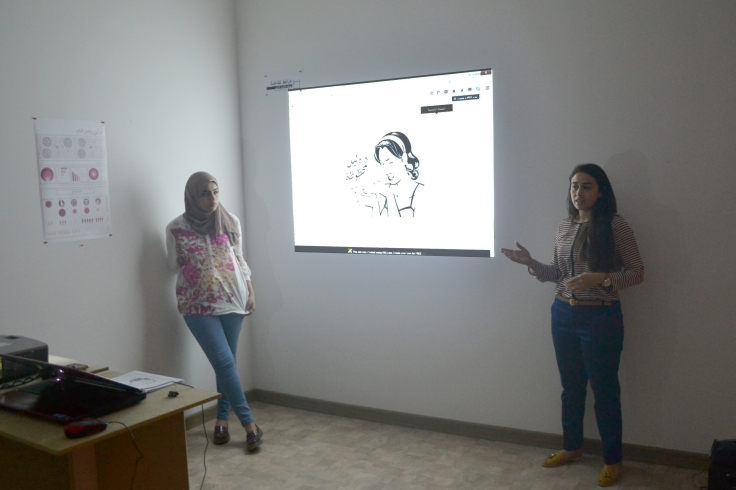
A project by Dalia Gamal and Menna Essam

Maps and the art of mapping are models of concision, it raps up everything that surrounds us in the world. Starting from the zoomed out map (world map) to the zoomed in maps which are the most detailed ones such as mind map, emotional maps and daily life mapping.

Today maps are represented in different ways and mediums not only a 2D drawings on papers, but now there is applications, short films, online websites, etc.

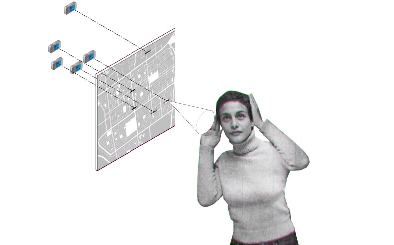
We as human use our “spatial abilities”, which are skills we use to manipulate 3D shapes and geometric information in our heads.

According to Geographer Amy Lobben of the University of Oregon, in 2007, discovery which was finding out the “self-location” is the most important “spatial-ability” key for map reading, the ability to relate where you are in the real world to corresponding spot on a map by observing roads, building and intersections.

We decoded to transform a 2D map into 3D map, because it’s easier to read and understand it and because people find a 2D maps are boring and non-interactive like 3D ones. We came up with a game to help people visualize the places and streets they have been there before and draw and recreate their own 2D maps in their own heads according to their experience.


“ What I would love to do is to personalize navigation systems based on simple cognitive tests that determine what really need to help you navigate better.” Amy Lobben, compensating for individual difference in perspective shifting will require more research to better understand the nature of the difficulty, Lobben says. The sorts of things that might help, she suggests, include features that zoom smoothly in and out from the street view to map view, or circles and arrows that indicate a user’s currant location and heading.

Combining brain science and cartography could also lead into other interesting areas. For examples, in some of their FMRI studies Lobben and her colleagues have noticed interesting activity in the par hippocampal place area, a brain region that seems to respond preferentially for images of places. Other researchers have found that the PPA, as it’s known for short, fires up when people view photos of rooms, city streets, famous landmarks, and all sorts of other places.


Creating this game was determined to achieve those reasons and more:


-Helps people to memorize street names.

-Testing knowledge that people have about street names, it’s history, it’s location and the reason for choosing the name.

-Entertaining people with something useful and related to their work, residence, life and city.

-Rediscover neighborhoods and city that people are surrounded by.

-Nourishing people’s memory about places and their locations.


Inspiration     


Inspired by crossword puzzle one of the most popular games in the world, found in newspaper and recently online and in applications on smart-phones. It helps people to nourish their memory and think more to guess the words and solve the game and being a useful time investment and entertainment. A CROSS STREETS GAME came up. A game that could be found in newspaper or online, to be easily found and played anywhere and anytime.

The game contains photos and clues about the streets, and by following them the player should be able to know the street name in order to solve it and figure out the hidden clue. The game has different levels of complexity to be more challenging, specially when played as a group game. Human are able to imagine and recognize 3D physical shapes better than 2D elements. From this the game was designed to be solved by following the clues which are attached to the game and all of them are 3D physical elements such as places or buildings people might have been in or around them before.


Transformation


Following the idea/form of the crossword puzzle, the game form/shape was designed. People will find empty squares on the board and by the help of the photos and the hidden clues they should be able to recognize the street name. After filling all the empty squares, another street name will start to appear and this is the final name they should figure it out before flipping the board. The last name does not have a direct clue or information like the other names. The only way to figure is by solving all the puzzle.

Finally, after finding out the last name which is crossing all the other name. The player can flip the board to get the information about the street like it’s history, important buildings in the street and reason behind the name.

The game has different levels and each level is more difficult than other and is about a different area. Till they complete Cairo.

Contemporary Architectural Identity in Cairo and the Real-Estate Gurus دليلك لتصبح أحد حيتان العقارات في القاهرة

A project by Ibrahim Hany Anwar

This mapping aims to make the statement that almost all new developments in the last  years have lacked their own identity, innovation and contextual sensibility.

This is an abstract mapping that sheds the light on the formation of Gated Communities in New Cairo,  which represents the biggest organized Real Estate effort in the city’s expansion. Focus is set on the advertisement and the architectural morphology produced. This project briefly questions how this pattern of development with its architectural and social model associated affected the planning of the city.

Besides this research,is a a fold-up brochure that sarcastically tells the story of a real estate guru. As one reads through the formation of gated communities is discussed, their advertisement and eventually their overlooked implications.

WALL POSTER


A citizen’s guide to the street bumps of Cairo

A project by Alia Aboelghiet and Yomna Hossam

mobileapps_youmna&

One of the most prominent feautures of the streets of Cairo is the un-designed bumps and holes. Alia and Youma’s project aimed at creating an Other map of Cairo out of a crowd sourced data collected via their mobile application “Khoud Ballak“(Take care). The app works on classifying the level of damage caused by the street bumps and holes and linked to way finding applications like Heremaps and Google maps into four levels. The app also directs the driver to the nearest service garage.


The data gathered through this app led Alia and Yomna to complete their research on the bottom up ways the Carienes have figured out to deal with this prominent problem of poor infrastructure. As a sample for this bigger research they decided to demonstrate their idea by working on Heliopolis.


The Mouleds of Cairo موالد القاهرة

A project by Habiba Abdel Kader

Lights everywhere, decorated mosque, sound of chanting , music, street vendors selling goods , children riding games , tents , food , worshipers and so much more, if you found yourself in a similar scene then you are definitely in a Sufi Mouled.

The word Mouled in Arabic literally means “anniversary” The Mouled is a celebration
that takes place on a fixed date every year to celebrate a certain Waly’s (Saint) death or birth. The Mouled is a global phenomenon that happens in a lot of places around the world it may have different names and various ways of being practiced but at the end they all have the same core concept. Mouleds are not restricted on a single religion for example in Egypt there are “mouleds” for Christian saint such as “Margerguis” and The Mouled of “abo Hassira” which is celebrated by Jews in the governorate of Damanhur in Egypt.

DSC_0113

This concept of spiritual and religious form of celebration dates back to Ancient Egypt but the recent form of the mouled was first introduced by the Fatemids .The Mouled is a phenomenon that has been a strong pillar in the Native Egyptian folklore, it evolved and changed along the years but it is still celebrated all over the country till this day. This Phenomenon has been studied from several aspects; social, economic, religious etc.
yet very limited numbers of studies have tackled the urban impact of the Mouled.


This booklet sheds light on Mouleds and how they affect the everyday life of the residents of Cairo , psychologically , economically , socially as well as from and urban point of view as well as discussing the historical background of Mouleds , principals, common traits, the 5 biggest and most important Mouleds in Cairo and analyzing several layers of impacts that they leave on their urban context.


Blog at WordPress.com.

Up ↑